LYNX Blue Line
19.3 miles, 26 stations, about 62 minutes end to end (scheduled) — read top to bottom the way a map has it, UNC Charlotte–Main down to I-485/South Boulevard.
These are the line's places — what sits within a ten-minute walk of each platform. Most of the city is off the spine; the map and the A–Z carry all of it.
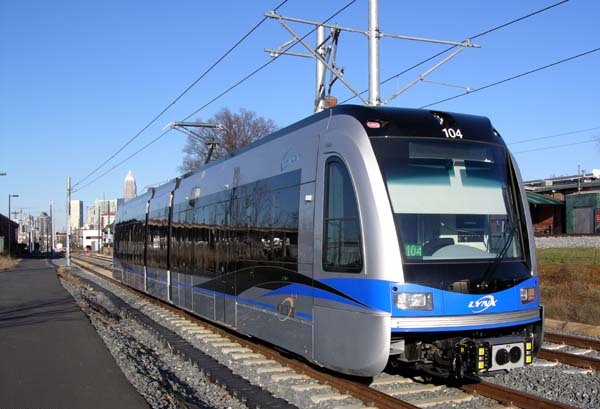
The Blue Line runs this whole page, end to end, every day.
UNC Charlotte–Main
Station 26 of 26 · University City
JW Clay Boulevard/UNC Charlotte
Station 25 of 26 · University City
McCullough
Station 24 of 26 · University City
University City Boulevard
Station 23 of 26 · University City
Tom Hunter
Station 22 of 26 · North Charlotte
Old Concord Road
Station 21 of 26 · North Charlotte
Sugar Creek
Station 20 of 26 · North Charlotte
36th Street
Station 19 of 26 · NoDa
- Amélie's French Bakery & Café (NoDa)Breakfast
- Brooks' Sandwich HouseTakeout & Grab-and-Go
- Cabo Fish TacoSit-Down Dining
- Curio, Craft & ConjureShopping
- HaberdishSit-Down Dining
- Heist BreweryBreweries
- Historic RosedaleHistorical
- Neighborhood TheatreLive music
- Smelly Cat Coffeehouse & RoasteryCoffee
- The Chamber by Wooden RobotBreweries
- The Chamber Run ClubClubs & Leagues
- The Evening MuseLive music
- Zanzibar CafeSit-Down Dining
25th Street
Station 18 of 26 · NoDa
Parkwood
Station 17 of 26 · NoDa
9th Street
Station 16 of 26 · First Ward
7th Street
Station 15 of 26 · First Ward
- Carolina TheatreLive music
- Discovery Place ScienceMuseums
- First Baptist Church (Spirit Square)Historical
- First United Presbyterian ChurchWorship
- First Ward ParkPark
- Fourth Ward ParkPark
- Little Rock A.M.E. Zion ChurchWorship
- Mert's Heart And SoulSit-Down Dining
- St. Peter's Episcopal ChurchWorship
- The Dunhill HotelLandmark
- The Market at 7th StreetTakeout & Grab-and-Go
Charlotte Transportation Center
Station 14 of 26 · First Ward
Change here for the Gold Line — the network's transfer station.
- Bank of America Heritage CenterMuseums
- Belk Theater at Blumenthal Performing Arts CenterLive music
- First Presbyterian ChurchWorship
- Grand Bohemian Hotel CharlotteLandmark
- Independence Square (Trade & Tryon)Historical
- McColl ParkPark
- Monarch MarketTakeout & Grab-and-Go
- Moxy Charlotte DowntownPlaces to Stay
- Rooster's Wood-fired KitchenSit-Down Dining
- Spectrum CenterSports venues
- The Ivey's HotelPlaces to Stay
- The Ritz-Carlton, CharlottePlaces to Stay
3rd Street/Convention Center
Station 13 of 26 · Second Ward
- Famous Toastery (Uptown)Breakfast
- First Baptist CharlotteWorship
- Grace A.M.E. Zion ChurchHistorical
- Hilton Charlotte UptownPlaces to Stay
- Kimpton Tryon Park HotelPlaces to Stay
- Marshall ParkPark
- Mecklenburg County Aquatic CenterActivity
- Middle C JazzLive music
- Romare Bearden ParkPark
- Second Ward High School GymnasiumHistorical
- Truist FieldSports venues
- Uptown Farmers MarketShopping
Brooklyn Village
Station 12 of 26 · Second Ward
Carson
Station 11 of 26 · South End
No guide places within a ten-minute walk of this platform yet.
Bland Street
Station 10 of 26 · South End
East/West Boulevard
Station 9 of 26 · South End
New Bern
Station 8 of 26 · South End
Scaleybark
Station 7 of 26 · LoSo & South Boulevard
Woodlawn
Station 6 of 26 · LoSo & South Boulevard
Tyvola
Station 5 of 26 · LoSo & South Boulevard
Archdale
Station 4 of 26 · LoSo & South Boulevard
Arrowood
Station 3 of 26 · LoSo & South Boulevard
No guide places within a ten-minute walk of this platform yet.
Sharon Road West
Station 2 of 26 · LoSo & South Boulevard
No guide places within a ten-minute walk of this platform yet.
I-485/South Boulevard
Station 1 of 26 · LoSo & South Boulevard
No guide places within a ten-minute walk of this platform yet.
The whole day at once, if you would rather read the line the way a dispatcher does — every scheduled run a diagonal, and the trains above riding them right now.
PLATE VI — THE TIMETABLE
Every weekday run on the LYNX Blue Line, drawn as one day
northbound to UNC Charlotte–Main · the return direction · a train right now, placed where it rides
Read this figure as text
The weekday pattern on the LYNX Blue Line, derived from the CATS static timetable (feed 2026-08-03): headway-spaced representative runs, not per-trip times. The other day type redraws with its own headways and span.
| Direction | First departure | Last departure | Runs drawn |
|---|---|---|---|
| northbound to UNC Charlotte–Main | 5:20 AM | 1:08 AM | 92 |
| southbound to I-485/South Boulevard | 5:00 AM | 12:52 AM | 93 |
| Hours (weekday) | A train about every |
|---|---|
| 5:00 AM – 6:00 AM | 12 minutes |
| 6:00 AM – 9:00 AM | 11 minutes |
| 9:00 AM – 3:00 PM | 13 minutes |
| 3:00 PM – 7:00 PM | 12 minutes |
| 7:00 PM – 9:00 PM | 14 minutes |
| 9:00 PM – 1:00 AM | 16 minutes |
| Station | Miles | Min, northbound | Min, southbound |
|---|---|---|---|
| I-485/South Boulevard | 0.0 | 0 | 62 |
| Sharon Road West | 0.9 | 2 | 59 |
| Arrowood | 2.0 | 5 | 56 |
| Archdale | 3.2 | 8 | 53 |
| Tyvola | 3.9 | 10 | 51 |
| Woodlawn | 4.8 | 12 | 49 |
| Scaleybark | 5.9 | 15 | 46 |
| New Bern | 6.6 | 17 | 44 |
| East/West Boulevard | 7.6 | 20 | 41 |
| Bland Street | 7.9 | 22 | 39 |
| Carson | 8.2 | 24 | 38 |
| Brooklyn Village | 8.5 | 25 | 37 |
| 3rd Street/Convention Center | 8.8 | 27 | 35 |
| Charlotte Transportation Center | 9.0 | 29 | 34 |
| 7th Street | 9.2 | 31 | 32 |
| 9th Street | 9.4 | 33 | 30 |
| Parkwood | 10.3 | 36 | 27 |
| 25th Street | 10.7 | 38 | 25 |
| 36th Street | 11.5 | 40 | 22 |
| Sugar Creek | 12.3 | 43 | 20 |
| Old Concord Road | 13.6 | 46 | 16 |
| Tom Hunter | 14.9 | 49 | 12 |
| University City Boulevard | 15.6 | 51 | 9 |
| McCullough | 16.6 | 54 | 6 |
| JW Clay Boulevard/UNC Charlotte | 17.4 | 56 | 3 |
| UNC Charlotte–Main | 18.1 | 59 | 0 |